
Why I Like This Hike:
Non-technical glacier hike suitable for most skill levels with great views of Mt. Blackburn, Regal Mountain, and Donaho Peak. This trail is generally rated easy / intermediate due to its grade and creek crossings. You can safely hike the glacier on your own with micro-spikes (or take the glacier tour and they will provide crampons.) This is an incredible glacier hike and well worth it if you (and your vehicle) can survive the drive from Chitna,Google Maps Driving Directions - Kennecott-McCarthy
This trail departs from Kennecott Mill Town and you must access Kennecott from McCarthy by either walking the road between McCarthy and Kennecott (an extra 4.5 miles), taking the commercial shuttle, or riding a bike. If you plan to take the shuttle (recommended) be sure to check the schedule as it operates seasonally.
According to the NPS website: There are 3 shuttle companies providing services between the pedestrian footbridge, McCarthy and Kennecott, with multiple stops in between. Each company has its own schedule and pricing and runs approximately every hour to 1/2 hour. Shuttle company contact information can be found on the sign at the footbridge, at the end of the McCarthy Road. Shuttle Services
To access the trail from the Kennecott Visitor Center, walk through the Kennecott Mill Town, north towards the Root Glacier. About a half-mile beyond the visitor center, the road will split. Take the left hand trail. The trail will soon cross over Bonanza Creek and then wind its way through the lateral moraines of the Kennicott and Root Glaciers. After about a mile the trail curves sharply to the right and uphill, follow the trail to cross Jumbo Creek on the footbridge. After approximately another 1/4 mile, the trail reaches the Root Glacier access trail. (Primitive campsites, along with an outhouse and food lockers, are available in this area.)

To access the glacier, turn left at the sign and follow the trail as it winds down the moraine to the toe of the glacier. If you decide to walk on the glacier, use caution as the ice can be very slippery. The main trail continues past the turn to the glacier paralleling the glacier for approximately 2+ more miles. Near the end, Erie Mine bunkhouse is visible high above on the hillside to the right of the trail, the Root Glacier is below on the left, and the Stairway Icefall is further up valley.
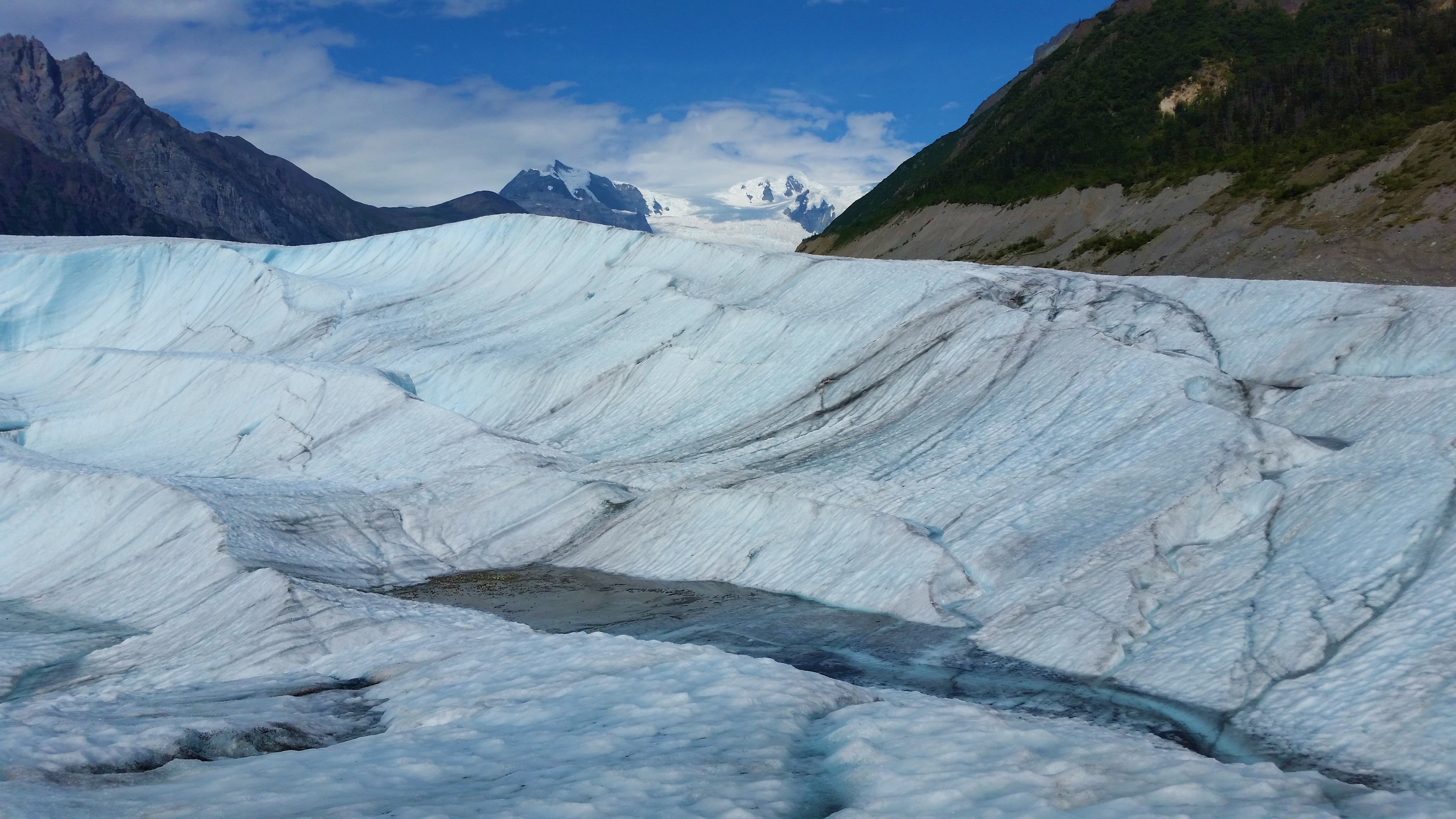
Although the NPS does not require you to hire a guide to explore the Root Glacier, it can be very slippery so it is recommended to wear crampons or ice spikes on your shoes. Otherwise there are guided tours available where crampons will be provided. Avoid crevices and walking along the edge of Root Glacier as rotting ice and swift, cold water are potentially dangerous.
For more details on hiking the glacier, check the links below or the guide books.
Since you drove the 60 miles of rough road from Chitina to McCarthy, you will also want to checkout the historic Kennecott Mine. The road ends at the footbridge so you will need to take the shuttle to the mine (about 4.5 miles.) The NPS has been restoring some original buildings (with interpretive displays inside) which you can now enter at no charge. You can't enter the Mill Building unless you take the tour so don't miss this, it's well worth it. There's a private campground and parking at the footbridge. A word of caution, if you drive the unimproved road from Chitina to McCarthy, be sure to bring at least one good spare and tire repair kit. Flat tires are a common occurrence.
For more on Kennecott, go to links & Facebook page below. (More detailed information with each FB picture.)
Comments