
This is a quintessential Alaskan hike, family friendly and suitable for most skill levels. It's about 4.4 miles to Rabbit Lake, a large beautiful alpine lake some 3,000 feet above sea level in the shadow of 5,000-foot Suicide peaks. Once at the lake, the hiker has a number of options including hiking, camping and climbing nearby peaks. This trek is a short drive from Anchorage and can be hiked in all seasons depending on weather.
This hike is extremely popular during the summer so be advised that parking can be very limited at the Upper Canyon Road trailhead.

The Nitty-Gritty:

Google Driving Directions: Rabbit Lake Trailhead
This hike is extremely popular during the summer so be advised that parking can be very limited at the Upper Canyon Road trailhead.
Overview:
There are two main routes to Rabbit Lake, the easier is from Upper Canyon Road off DeArmoun. The longer and steeper route starts from the McHugh Creek trailhead. You can hike to Rabbit Lake in a day (out and back) from either trailhead or as a one-way "through" hike. This post will describe the day hike from the Upper Canyon Road trailhead.
Click on link for a State of Alaska, DNR Map of Rabbit Lake Trail

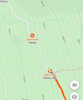
The trail to Rabbit Lake begins at the end of the steep Upper Canyon Road. The trailhead is located beyond the gate at the upper end of the parking area. You will pass the Flattop Sunnyside Trail. (See graphic below.)

In fact, most of the trail is a continuation of the old road bed as it winds its way up the valley to the lake gradually climbing 1,300 feet. Near the end of this climb, you’ll finally end up on top of a knoll above the last trees. At this point you’ll have a view of Rabbit Lake, still some two miles away. The lake fills almost the entire upper end of the valley below the rock-walled summits of North Suicide Peak (elev. 5065 ft.) and South Suicide Peak (elev. 5005 ft.).
Drop onto the flats on the far side of this knoll and follow Rabbit Creek up the valley to reach Rabbit Lake. Be prepared for weather changes along these last few miles. Winds can pour through Windy Gap at the head of the valley between the two Suicide peaks making for very rapid changes in temperature. While relaxing by the lake, take a moment to soak up the views as you now sit some 3,000 feet above sea level in the shadow of two near-sheer faces of the 5,000-foot Suicide peaks.

Options:
Just over the low pass on the far side of Rabbit Creek lies McHugh Creek Trail. This leads you a short way down to McHugh Lake, and then all the way down that valley to the McHugh Creek Picnic Area. For other hiking/climbing options in the area, such as the Suicide and McHugh peaks, check the guide books. My "go-to is "50 Hikes in Alaska's Chugach State Park"

 |
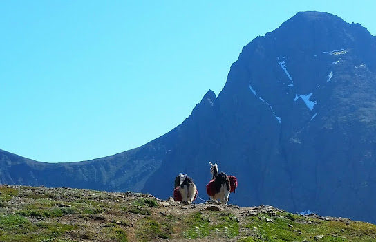
| Time-out for "Llama Selfies" |